Ward Other Landuse Area 2005

[colored]Other Landuse Area[/colored]
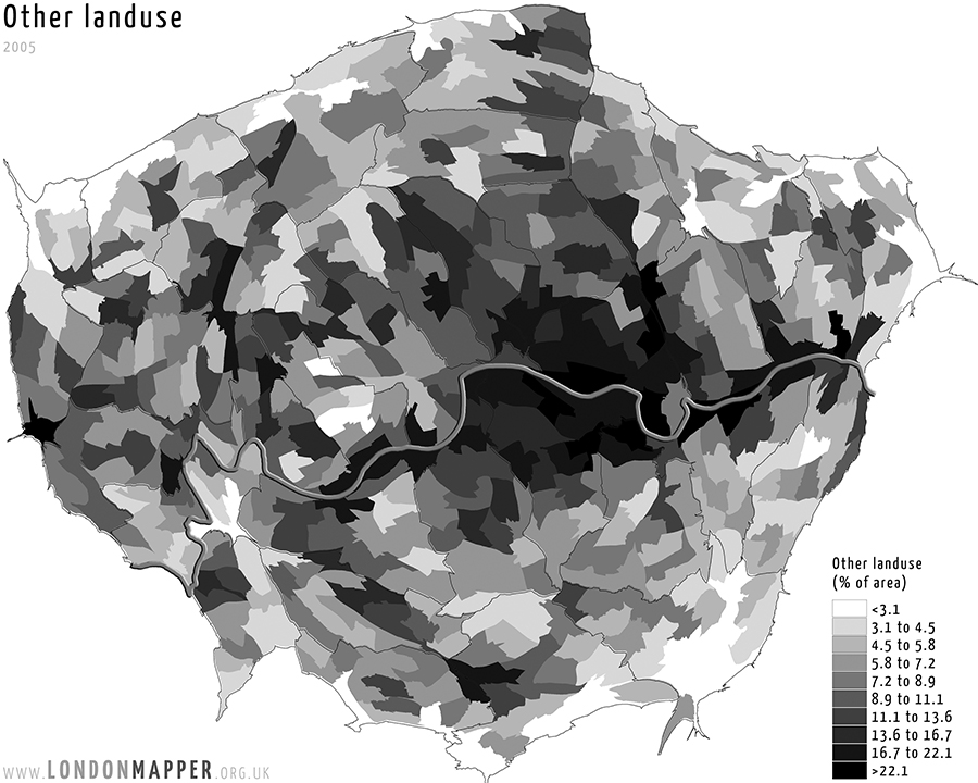
[dropcap1][colored]T[/colored][/dropcap1]his map shows the area of London resized according to the total number people living in each of the grid cells as recorded in the 2011 Census. Overlaid on the basemap is the share of other landuse area within an area as estimated for 2005.

[h5]Go To Main Topics[/h5]